Monday 28 May 2012

A Lap of Haweswater

Sitting on the far eastern side of the Lake District National Park, Haweswater is one of the trickier lakes to get to and because of that it’s usually one of the quietest. To get there by road you’ll need to head up through Shap and follow the signposts down to the lake.  Well, technically it’s a reservoir supplying the people of Manchester but, as I’m writing about the Lake District and not the Reservoir district, I shall be referring to it as a lake.  In fact, here’s a challenge for you; which of the lakes in the Lake District is the only one that is actually called a lake (as opposed to a mere, tarn, water or reservoir)?  Answer at the end.

Haweswater is just over 4 miles long and a full lap comes in at around 10 miles.  It’s an easy walk with a clear path the whole and perfect for the very hot and sunny day we attempted it on.  We parked up in a layby at the northern end and set off for an anticlockwise lap.  The dam itself is an impressive structure and was the first hollow dam of its type in the world, though when work started in 1929 it was massively controversial.  This was due to the fact that by building the dam and creating the reservoir the villages of Measand and Mardale Green would be flooded and lost forever.  The dry stone walls disappearing into the lake at the water’s edge are a clear reminder of what was once there and, during periods of drought, many of the old village buildings reappear from their watery resting place.

First up on the walk is the village of Burnbanks which was built to house the dam workers.  It fell into disrepair but has now been restored and is a very pretty little collection of small bungalows.  The footpath is clearly signposted out of the village and the first thing we saw as we made our way towards the lake was a red deer, but you’ll have to trust me on that one as the pesky thing moved too quickly for me to get a photo.

According to those protesting about the flooding of the valley it was one of the prettiest in Westmorland; well they may have flooded it but it’s still very pretty.  As you hike southwards looming up ahead of 
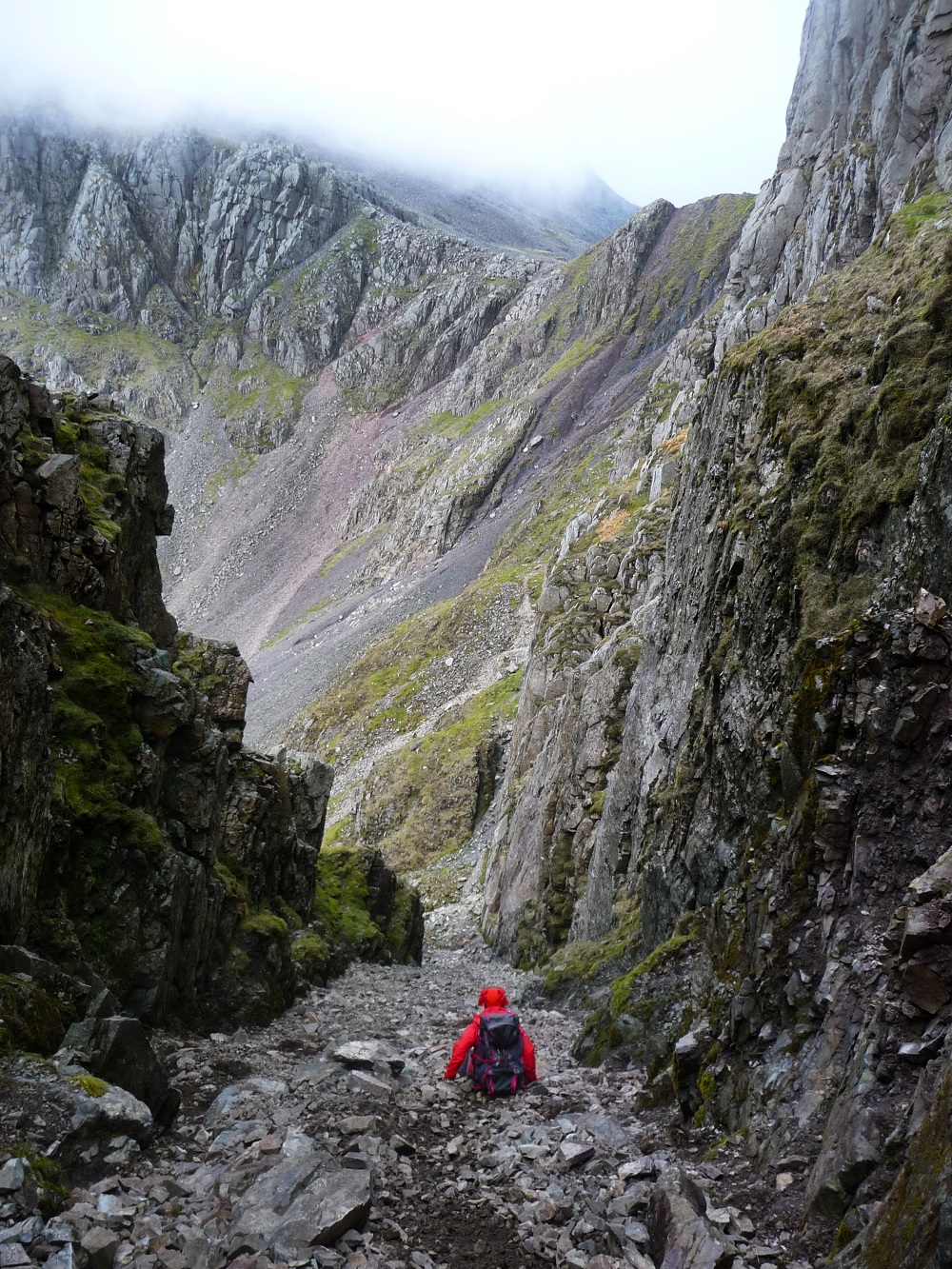
you are Branstree, Harter Fell and High Street and you’ll be hard pressed to find many finer views.  As we walked we noticed a lot of strange loud booming noises; we’re guessing this has something to do with the reservoir, but would welcome any suggestions as to their origin.

After a delightful pause for lunch we arrived at Riggindale; home to our very own Golden Eagle.  The RSPB has a manned station along the valley where they train telescopes to help you spot the elusive resident.  I can’t claim to have seen him clearly, but I can claim to have seen a blurry eagle like shape perched in amongst the scree.  The poor thing has been alone for the past 7 years; well apart from several dozen people spying on him on a daily basis.  Hopefully he’s enjoying his bachelor lifestyle and won’t be deserting us to seek companionship further north.


Passing the car park at Mardale Head we started on our journey north.  The footpath here is a little trickier to navigate as for the most part it traverses the steep grassy banks of the lake.  It’s one of those paths where could really do with your right leg being about 6 inches shorter than your left.  There are so many spectacular viewpoints along this stretch that it was really hard to pick out the few key photos which really do it justice.  Technically if you look at the photo of Riggindale valley then you should be able to see a Golden Eagle in there, it’s highly unlikely though.

The last major landmark along the route is the Pier and whenever I see stuff like this I’m impressed at how ornate they are.  Back in the day it wasn’t enough for things to just be functional; they also had to look good too.  Long before everything simply went to the lowest bidder people weren’t afraid to jazz things up a little and I’m jolly glad they did too.  The three stone arches and final turret blend into the landscape of fields and dry stone walls in a way that a purely functional structure never could.

Continuing north it wasn’t long before we passed the hotel where those of a weaker constitution can stop for a nice cold beer and a rest.  Please don’t think I’m implying that we are in anyway made of sterner stuff than the rest of the population, I’m simply implying we forgot to bring any money with us.  Thankfully it wasn’t long before we were back at the car/ greenhouse desperately trying to cool it down a little before heading home.

This hike was an important milestone for us as we finally broke the curse of Haweswater; on each of our previous visits we’ve had to abort or change our plans mainly due to my overly optimistic faith in the prevailing weather conditions.  This time, even though clear hot weather was forecast for every part of the UK for today and the coming week, I packed my waterproofs, just in case, and it clearly did the trick.  Oh, and the answer to the question at the start is that Basenthwaite Lake is the only “lake” in the Lake district.  Might come in handy next time you’re in a pub quiz. 


Sunday 20 May 2012

Derwent & Catbells

Twice I’ve set off with the intention of walking around Derwent and twice I’ve got distracted and done something else.  I hope it’s not the sort of lake which takes that kind of thing personally.  The truth is Dewent and Catbells have great personal significance for me as that’s where my love affair with the Lake District fells began.


Back in August 2010 we visited Grange (in Borrowdale) as part of an extended tour of the north in our trusty campervan Delores.  By January 2011 I’d found a new job and we moved up here, though still in Delores as we hadn’t quite managed to find a house at that stage.  Steve had grown up in the area but amazingly that was my first ever visit.  During that first visit I also discovered my alarming magnetic attraction for the fells.

We’d parked up in Grange and decided that after lunch we’d take a walk around the lake with a break at Keswick for a spot of dinner – perfect plan.  So off we set along the west side of the lake, but it wasn’t long before something rather odd began to happen.  Try as I might I couldn’t walk in a straight line.  However hard I tried to point my boots towards Keswick they insisted on veering off left towards Catbells.  We made it as far as Derwent Bay before the boots won and up we went.

I’ll be honest; I had no map, no compass and no food.  We were massively underprepared but it was a clear, sunny day and Catbells had her very best “come hither” look, so who was I to argue?  We started on the lower path but impatience got the better of me and when we reached Skelgill Bank we switched to the vertical option.  I’d like to tell you how when we reached the summit we admired Skiddaw and Blencathra, but the truth is I had no idea what the fells were called, I just knew they’d been added to my list.

So what about the second time I tried to walk around Derwent?  Well that was yesterday and this time I’m blaming Chris Bonington for my failure to make it round.  We were headed for Keswick Mountain Festival and, knowing there would be little parking in town, parked up under Walla Crag.  This time we were planning to take the lakeside route to Keswick for a spot of lunch, tootle around the festival for a while then complete a lap of the lake, but when we got there there was so much to do that we soon became very distracted.

There was a huge array of tents selling everything the outdoors enthusiast could ever need – including hot pork sandwiches so that was lunch sorted.  Next we got distracted by the Berghaus tent where Silva were giving free navigation courses.  Since I’ve always taken charge of the map and compass I thought it was about Steve got to grips with it all and, seeing as how he was never going to listen to me, this seemed perfect.  90 minutes of tuition in the lovely Castlehead Wood and he was sorted.  And hooked.  I may never see my compass again.

Returning to the Berghaus tent I spotted one of my heroes; Chris Bonington.  Whilst I’m new to the Lakes I’m not new to the outdoors and have been an avid reader and collector of mountaineering books for many years.  I’m a particular fan of early explorers, adventurers and people who are more interested in forging new routes than simply following what others before them have done.  Luckily Chris Bonington was utterly charming and happily posed for a photo with me, even giving me a bit of a hug.  I’d like to say that I took the opportunity to express my deep admiration of all that he has achieved but the reality is I babbled like an excited schoolgirl and probably said something inane.  Perhaps seeing I was somewhat over excited by this encounter the lovely Matt (Berghaus marketing supremo) thrust a bottle of Berghaus brew into my hands and I retired to a small grassy knoll to recover with Steve and a large bag of Ritz crackers.


By the time I returned to my senses and we’d taken another tour of the field – this time discovering the outdoor swimming group which I’m now determined to join – it was getting late and we noticed the last speaker of the day in the Berghaus tent was Gordon Stainforth talking about Adventure and his new book Fiva “An adventure that went wrong.”, a phrase which could also be used to describe my second failed attempt to circle Derwent.  Next time I promise I’ll make it the whole way around; well, maybe…


Thursday 17 May 2012

Sharp Edge -v- Striding Edge


Striding Edge and Sharp Edge are two of the most notorious routes in the Lake District and, having completed both of them, I've been asked what the difference is between them, so here goes.

Let's kick off with Striding Edge.  We've been up Helvellyn via just about every available route in a wide variety of weather conditions, including snow, and Striding Edge never fails to impress – either to climb across or simply to look at.

The Striding Edge ascent kicks off in Glenridding where it's pretty much impossible to find free parking.  If you don't mind adding an extra mile or two to your journey then you can probably find a slot in a layby if you're early enough, but it's a popular spot so don't build your hopes.  Also bear in mind that after you've spent a full day tackling a challenging route like Striding Edge you'll want the car to be as near as possible when you're done.

The first time we tackled Helvellyn we went up via Striding Edge and just for good measure nipped along Swirral Edge to Catstye Cam.  Then a long descent via Dollywaggon Pike and Grisedale Tarn with a very pleasant stroll along Grisedale Beck back to the car.  A grand total of 6 peaks and well over 15 miles of yomping, none of it flat.  We didn’t rush and were out there for over 9 hours, but it was worth it.  The views down over Ullswater were amazing, the rock climbing was fun and all that exercise meant I could scoff fish and chips in the evening with complete impunity.

The ascent begins very gently with vistas down and across Ullswater opening up as you gain height and you don't get to see much of the scary bit before you're on top of it.  I'd strongly recommend a good rest before getting stuck in, it's a tiring route and once you're committed there are no real rest stops before the summit.

As with all the tricky routes we've tackled Striding Edge is fine if you take a well-paced and sensible approach.  Yes it's a bit of a scramble but there's a well-worn route which is easy to follow.  The views are, by turn, both breathtaking and terrifying.  It is a truly exhilarating experience to be high up on the long ridge in the middle of such spectacular scenery and watch the sides of the ridge tumble away steeply either side of you.  There are various memorials along the way to remind you that this is a dangerous route so, if you want to admire the scenery, find a secure place to stop before you take your eyes off where you're putting your feet.

Striding Edge doesn't end there though, once you've reached the far side there is a strenuous scramble up to the summit ridge.  There are plenty of hand and foot holds and it's as fun as it is tiring.  It's a fabulous feeling to complete the climb and do make sure you head around towards Dollywagon Pike to get some great shots to impress the folks back home.

So how is Sharp Edge different?  Part of the beauty of Blencathra is that it's not lost in a sea of other peaks and can be seen away in the distance as you head north along Thirlmere.  We completed a circular route starting at Threlkeld, heading over towards Scales Farm and up onto the summit via Sharp Edge; we then walked the ridge route and dropped back down to Blencathra Centre before staggering back into Threlkeld.  Part of the challenge was that we tackled it on one of the hottest days of last year, so we made the most of the many gills to top up the water bottles, alternating between pouring water down our throats and down our backs.


As we ate lunch at Scales Tarn we watched various people heading up and along Sharp Edge and figured that if they could do it, then so could we.  Replete, we headed upwards.  Sharp Edge is narrower but shorter than Striding Edge in fact it's rather like a condensed version; shorter, scarier and, of course, sharper.  Unlike Striding Edge you can see Sharp Edge very clearly as you make your way up towards it and that certainly adds to the anticipation as well as driving up your adrenaline levels.  It's perfectly achievable so long as you take your time. The biggest challenge are the large flat sheets of rock which offer very little in the way of hand or footholds.  It's also tricky when you meet people coming the other way as there aren't many passing places.

The rock climb at the end is a certainly more of a challenge than the scramble up to Helvellyn; again the large flat sheets of rock are the biggest issue when looking for grip.  That said, with decent boots and a sensible head it shouldn't prove too much of a problem for most folks – just take your time and don't try anything fancy. 


So there you go, both edges done.  I will happily return to tackle them both again in the future, but for anyone other than the experienced climber they are strictly fair weather routes.  We're seasoned hikers and found both of them challenging enough on dry, clear, calm days. When it's snowy we stick with the safer routes and content ourselves with admiring the "edges" from afar, much safer that way.

Sunday 13 May 2012

A bunny, a plane, a hike and a pint.


When we lived "darn sarf" we lived very near to Farnborough and every other year would pack a picnic, find a spot on the nearby heathland and enjoy the free spectacle of the airshow.  We thought we'd left all that behind when we moved up here but turns out Windermere has an airshow too, or rather, had an airshow as last year appears to have been their last, at least for now.  In our quest to be cheapskates and find a free viewing spot we also found a wonderful walk and a sublime little pub whose chips rank my top 5 "best pub chips ever", and let me tell you, I'm very fussy about my chips.

But first the walk.  We started off from a layby just south of Near Sawrey and the Beatrix Potter fans amongst you will immediately know why there's a bunny involved.  Near Sawrey is the site of Hill Top farm where the amazing Beatrix Potter lived.  I confess I didn't know an awful lot about her before our move here, but she really was a remarkable woman and if it weren't for her we probably wouldn't have much of a Lake District, a National Trust or many Herdwick Sheep.  I'm a big fan of strong minded women who don't do as they're told and the more I find out about her, the more I like her.  Hill Top is now owned by the National Trust and their car park is usually chocca but further down the road are a few laybys where you should find a space.

The footpath out of Near Sawrey is clearly signposted and heads gently up towards Moss Eccles Tarn, Wise Een Tarn and on into the woods.  Once up there you're spoilt for choice as there are many criss crossing routes through the woods.  It's certainly worth taking a detour out to Latterbarrow to enjoy the spectacular 360 degree views as you pop up out of the woods and onto the summit.  When you're done admiring the views my suggestion is to head back into the woods and aim for The Heald; a lovely wooded footpath which on hot days will keep you cool and on wet days will keep you dry.  Well, drier than you'd be on an exposed fell anyway.

As you wander along The Heald fabulous views will bob in and out of sight as the trees part and then regroup.  The trig point is almost hidden amongst enormous ferns, but there are loads of perfect picnic spots nearby for a very picturesque lunch.  The last of the top viewing points is at Scale Ivy Intakes and if you climb to the top of the small hills there you'll find the remains of an old farmbuilding - just so you know, I have first dibs if it's ever up for sale.  We watched most of the airshow from Scale Ivy Intakes and I'm not about to diss Farnborough airshow, but there is something quite spectacular about watching the Red Arrows group and swoop over the fells.

Once the excitement of the walk/ airshow is over it's time to head back to Near Sawry for a well earned pie and pint.  Now I don't think I've recommended any eating or drinking establishments thus far on my blog so this one must be really special, and it is.  Perched on a corner of the road you'll find Tower Bank Arms, and it is every bit as fabulous as it looks.  Be warned, you'll probably need to book ahead if you want dinner as it's a very popular spot.  The food is stunning and well priced and they have real proper cider on tap - the sort they have to disappear off into the basement to get.  And the chips, well, don't get me started on the chips; they are by FAR the very best chips within at least a 20 mile radius, if not further.

As I'd cunningly arranged for Steve to drive home I availed myself of a couple of pints of their local brew to wash down my huge and delightful dinner and then settled into the car for my chauffeur driven drive home.  A perfect end to a lovely day.


Scafell Pike & Lord's Rake Part 2

So, at the end of part I we were perched at the end of Mickledore looking for a route up onto Sca Fell.  From this starting point you have 2 options available to you; neither of them are easy, but both of them are fun.  We opted to start by dropping down underneath Broad Stand and then picking up the “path” to Foxes Tarn.  I’m making this sound an awful lot easier than it actually is.

The route down underneath Broad Stand is a very unstable scree slope which, just to make things interesting, is littered with tiny waterfalls which drip down onto you from the rocks of Sca Fell above.  As you slip and slither your way down this route you realise just how big and imposing Sca Fell is; all that scree has to come from somewhere so be sure to take things steady and keep your eyes and ears open the whole time. To be honest I did most of this on my backside and that turned into a bit of a theme for the rest of the afternoon and evening.  I have a pretty awful sense of balance so find it best to opt for as many points of contact as possible whenever the going gets slippy.  Unfortunately it means I get through a lot of walking trousers, which is expensive, but at least I remain intact.

At the end of Broad Stand the “path” up Sca Fell leads away to your right.  I say “path” because it’s actually a rock strewn gill with no real discernible path.  If you’re up for a scramble though it’s tremendous fun and there are plenty of hand and footholds along the way.  Of course being a gill means it’s slippy so don’t try anything heroic, this is about getting to the top in one piece and not setting any speed records.  At the top you’ll be rewarded with the tiny but perfectly proportioned Foxes Tarn; a perfectly peaceful sheltered little spot, ideal for the final flask of tea and a spot more chocolate.

Another scree scramble brings you to the summit ridge of Sca Fell.  We took a detour to the summit but sadly as we’d headed up the mist had come down, so there was nothing to see apart from showdy crags as the mist blew across.  So we braced ourselves and headed for Lord’s Rake.  Now, how do you tackle a challenging route if you’ve never done it before?  You keep your sensible head on, take your time and use all the experience you’ve gained from elsewhere to get you through safely.  If the Corridor Route had been easier than expected then this was definitely harder.

We dropped down off the summit via Symonds Knott and along Scafell Crag.  The entrance to Lord’s Rake is easy to spot but intimidating from the off.  If you are at all unsure of your ability to complete this route then stop now, return to the summit and head back via an alternate route.  The route drops very steeply down a muddy scree strewn slope, along a narrow path, up a heavily screed gully before the biggest drop which will return you to the main path down from the fell.  The route has been closed on regular occasions in the past due to land slips and it’s easy to see why.

We made our way very slowly and carefully down the first drop, keeping close to the edge and using the solid crags for balance.  The short narrow path at the bottom gives you a little breathing time before the final “up and over”.  I find it a lot easier climbing this stuff than I do descending it and we were soon at the top of the final, gut wrenching, descent.  It’s at moments like this that I question my sanity.  By now it was 7:30pm on a Saturday night and across the breadth of the land millions of people were curled up in front of the TV with a pizza and a glass of wine.  What on earth possessed me to be stood at the top of one of the trickiest descents in the Lake District with a dirty great grin on my face?  Clearly I need help!

It’s not the sort of drop you should stand staring at for too long, you’ll just scare yourself silly, so we set off, slowly and carefully making our way down the gully.  It is a genuinely dangerous route with the very real possibility of getting injured either from slipping on the scree or being knocked by rocks dislodged by the person above you.  Away down below us we could see the clear and stable route down off the fell, all we had to do was keep our heads long enough to reach it.  As we inched our way down it was apparent that there were some very recent rock falls, which didn’t do a lot for our nerves, but we persevered, keeping our wits about us at all times.  As we emerged from the main gully the ground became a lot firmer as we made our way back to the main path.  As I stood and looked back at it I couldn’t quite believe what I’d just done.


After all of that the rest of the descent was very straightforward and uneventful, the path is very clear and mainly paved and we were finally back at the car by 10pm.  Would I do Lord’s Rake again?  I very much doubt it, but I can’t wait to get back to Sca Fell, most definitely my new favourite fell to play on.


Scafell Pike & Lord's Rake Part 1

Question:  What do you do when work and family commitments have kept you away from the fells for a few weeks?  Answer: you cram your newly received Berghaus rucksack with as many warm clothes, food stuffs and flasks as it can handle and head for the hills.  We decided it was about time we tackled some of the big name routes that we hadn’t gotten around to yet, so we whizzed off to Wast Water, nabbed a parking spot near Wasdale Head and headed for the big lumpy stuff.

Our plan was to head up Scafell Pike but this time via the Corridor Route; after that we would drop down Mickledore to Sca Fell then down underneath Broad Stand and up onto Sca Fell via Foxes Tarn before finally descending via Lord’s Rake.  An ambitious plan but exactly what was needed to put the new rucksack through its paces.

If you’re not familiar with our hiking habits then you need to know that this time of year we are very late starters and it was 12:15pm before we left the car.  This routine usually works really well for us as we still have daylight until 10pm but most people have headed home long before then, thus giving us the peace and quiet we crave on the fells. 

The first part of the route was very easy, winding past St Olaf’s church, along Lingmell Beck and up to Sty Head tarn.  90 minutes later we were enjoying lunch in the sun overlooking the tarn and admiring the perfectly framed view of Blencathra away in the distance.  There was a cool breeze so we didn’t hang around long, plus we were keen to get stuck into the Corridor Route.  We were both under the impression that this was a tough and challenging route but the reality is that these days it’s a very straightforward and largely paved route up past Lingmell to Scafell Pike.  Don’t get me wrong, it’s very pretty, but if you’re after a challenging hike then this isn’t it.  It’s also far from quiet and we were passed by dozens of people as they made their way back down towards the tarn.

As we came up onto Lingmell Col we couldn't resist quickly nipping up to the top of Lingmell and enjoying the wonderful views of Great Gable – by far my favourite fell to look at.  It just looks like a “proper” fell; when you’re a kid and you draw a picture of a mountain, it looks like Great Gable.  Well mine did anyway.  That’s not to say my favourite cars are the ones that look like the ones I drew as a kid, for a start that would mean they’d all have very oddly shaped wheels… Anyway, back to the hike!

The final haul up to the summit of Scafell Pike is a bit of a scramble in places but still very straightforward and clearly marked.  Each time I ascend Scafell Pike I wonder how the height of the mountain is measured as it appears to be nothing but scree on the top; I wonder where the solid ground begins?  After the obligatory photos we huddled down beside the war memorial for a spot of drink and some chocolate before making our way over towards Mickledore.  (Incidentally, did you know that this whole area was gifted to the Lake District National Park following the death of its owner, Lord Leconfield, in World War I?)

The route down to Mickledore is well marked but you do need to watch your footing on the lose screes.  At the foot of the screes is a short col linking Scafell Pike with Sca Fell, this was easily passed in the good weather we had on Saturday but it’s not a route I’d fancy tackling in torrential rain.  Mind you there aren’t many routes that I think could be improved upon if only there were an apocalyptic downpour. 

As you cross the col towards Sca Fell you become immediately aware that you are now dealing with an entirely different type of fell.  Scafell Pike is the famous, sanitised fell that everybody wants to climb; Sca Fell on the other hand is big and brash and makes no concessions for anyone.  It reminded me in an odd way of Princes William and Harry.  Prince William (Scafell Pike) is the public face, the one that has to behave and be accessible to the public; Prince Harry (Sca Fell) on the other hand, can get away with being rather more mischievous and badly behaved.  I immediately warmed to Sca Fell…


Join me in part II when we scramble up a gill, successfully navigate through the mist and finally descend the infamous Lord’s Rake.


Friday 11 May 2012

Black Combe - the forgotten fell

I very nearly didn't write this blog, I mean, why would I tell everyone all about a spectacular fell when one of the things that made it so great was the fact it was practically deserted on a warm sunny Sunday in May?  But then I thought “what the hell – it’s way off the main routes, plus it’s not a Wainwright, so it will probably remain deserted whatever I say about it”, so here goes. (Although this isn’t one of Wainwright’s 214 fells it is included in his Outlying Fells book)

Black Combe is tucked away in the bottom left hand corner of the Lake District, or at least it’s as tucked away as a 600m fell can be.  It has sea to the south and east, the Duddon Estuary to the west and the fells of the Lake District to the north.  If you’re of a geological persuasion then you’ll love Black Combe’s almost perfect example of a corrie (starting point of a glacier) the feature which gave it its name.

Approaching from the east Black Combe’s gravitational pull kicks in as soon as you crest Kirkby Moor and spot it away in the distance.  The fact it’s so isolated makes it appear even larger than its 600m and it remains firmly in view as you wind your way around the Duddon Estuary.  We’ve passed it a few times on our way round to Wast Water and each time I’ve nearly pulled something in my neck as I crane to see it from every angle.  There are several routes up and we opted for the one that starts at Beckside farm; there’s a layby in front of the farm which can fit 7 or 8 cars if everyone parks sensibly, and there’s usually space available there.

The route winds up along Whitecombe Beck rising at a nice, sensible, Sunday afternoon pace.  The combined forces of Black Combe and White Combe envelope as you climb and at the end of the valley the Duddon Estuary creeps into view as you gradually gain height.   Popping out onto the main ridge at Whitecombe Edge the route up to Black Combe summit is clear and easy to follow.  The very worst thing I can say about this fell is that it’s a little boggy in places and there aren’t many places other than the summit cairns to sit and scoff your sarnies.  We went on a lovely dry day, but on a wet soggy Bank Holiday I’d recommend wellies.  Or maybe even waders.

Here’s a brief list of things you can see from the summit – some will clearly appeal more than others: Windscale/ Sellafield (or whatever it’s called these days), the stunning Cumbrian coastline, the enormous windfarm just off the coast, Walney Island, Peil Island (and castle), Barrow-in-Furness, the Duddon Estuary, the Old Man of Coniston and Scafell Pike & friends.  Wordsworth’s view of the view was “the amplest range of unobstructed prospect may be seen that British ground commands” – though that was probably before they built Windscale/ Sellafield/ Whatever.  On a clear day you can see the Isle of Man apparently but today was a bit on the hazy side so our views stopped at the windfarm, which we found oddly haunting.


To get back to the car we re-traced our steps as far as Whitecombe Head and then headed down over White Combe and White Hall Knott.  If you’re not pushed for time then nip along White Hall Knott to Swine Crag for wonderful views back up the valley.  Eventually, having loitered in every available view point until the tea ran out, we headed back down the car.  Along the entire route we only saw 5 people and they were all in the distance and the last section of the route was pleasingly overgrown and underused; a clear sign that this fell falls off most people’s “to do” list.  Which is a shame in many ways, but a good thing if, like me, you prefer your hikes a little on the antisocial side.


Monday 7 May 2012

Hide and Seek

Leighton Moss
I can't believe I've never been bird watching before.  If you've read previous blogs you'll know I've been trying to get to grips with identifying birds (specifically the "doink doink" bird) as we've hiked around the fells, but today was my very first time at an RSPB reserve with the specific intention of spotting birds, and what an amazing day we had; I'm not sure if it was just beginner's luck of if the birds are always this abundant up here.

Lapwing
We'd spent most of the morning hiking around Hutton Roof Crags (more of those in a future blog) and after a sarnie decided to head across to the RSPB nature reserve at Leighton Moss.  As RSPB members it was free to get in; it only costs us £3 per month for our membership so a very cheap day out.  The lovely lady at reception gave us a quick guide to the reserve and told us what birds had been spotted already today.  I mentioned that we were newbies and that I'd be hard pressed to tell a Pigeon from a Parakeet, but I was armed with my binoculars and my iChirp app and I was keen as mustard.

Black Tailed Godwits (apparently)
We started off at Lilian's Hide where there were dozens of Black Headed Gulls nesting and making a right old racket.  My none bird head wondered what I could possibly see here but I settled down with my binoculars and pretty soon I was engrossed in my own Attenborough style wildlife programme - except this was right in front of me.  I saw territorial battles, the odd spat and what I'm guessing was a demanding female bird beating up her hen pecked partner and demanding fish, which he duly supplied.

Marsh Harriers and Hutton Roof Crags
Leaving the screeching gulls behind we next headed for Tim Jackson hide and hunkered down for a spot more spotting.  I was immediately taken with a rather odd looking bird at the waters edge; large and blackish but with big pointy feathers sticking out of the back of its head.  I took a snap and started comparing it to the list of birds the RSPB had helpfully adorned the hide with and pretty soon it had a name: the Lapwing.  It didn't do much at first but then it began flying around and calling - what a brilliantly bonkers bird! It flies like it's been on the gin all day and sounds like a short wave radio.  In fact I think maybe those large feathers sticking out the back of its head disguise an antennae and it actually is receiving short wave radio.

Marsh Harrier
Whilst the Lapwing may have been relatively easy to identify other birds proved a little trickier, especially to a complete novice.  There were some brown speckledy birds wading around in the shallows and I'd thought they were Snipes, but a very nice man pointed out they were in fact Black Tailed Godwits and he was far more interested in them than he was in my Lapwing, but it was the two large brown birds away in the distance which were causing the most excitement.  When I asked what they were I was told they were Marsh Harriers and they were gamboling around in the air in much the way I might had I suddenly been granted the gift of flight.

Osprey
After a brief visit to Griesdale Hide we walked across the reserve to Lower Hide, which was very lovely and very quiet with nothing unusual to report, but we were in for a treat on our return journey.  As we passed a man gazing into the sky with his binoculars he turned and stopped us and asked if we'd seen the Osprey and pointed towards more large birds in the sky.  Our untrained eyes had thought these were still the Marsh Harriers, but apparently not and, once we got our eye in, we began to spot the differences.  I couldn't believe how lucky were were being on our very first ever bird watching trip and I was beginning to feel ever so slightly hooked on the activity.  I'd already decided that I needed new binoculars and Steve definitely needed upgraded camera equipment if he was to capture these amazing creatures on film.  (Well, OK, not "on film" anymore, but you know what I mean!).

Avocet
Our last stop of the day was over at Allen hide which is just down the road from the main nature reserve and overlooks Morecambe Bay, by now it was getting late (8pm) but we thought we'd pop over see what we could see.  Turns out we got to see Avocets.  These were the only birds of the day that I had never even heard of before.  I've watched nature programmes and heard most of the others mentioned but not these.  To be fair there were no experts around to back up our identification, but they are quite distinctive birds with beaks that curve upwards at the end so we're pretty sure we got it right - though please do let me know if we're wide of the mark.

After all that excitement we decided it was time to head for home.  On top of all the birds above we also saw loads of birds you might find in your garden, spotted a group of Swallows swooping and looping overhead and I think I may possibly have spotted a Bearded Tit in the reed beds, but it was too tiny and too far away to be sure.  And the perfect close to the day?  Being serenaded by the "doink doink" bird (or Nuthatch as he's better known) as we got back to the car.  Perfect.

Sunset over Kent Estuary

Wednesday 2 May 2012

Cross Bay Walk

After a week of fine clear weather the day of the walk dawned grey and overcast and the drizzle crawled along the train windows as we made our way over to Arnside for the start.  We’d had a heated debate about the footwear required before we set off with walking boots seeming inadequate against the paddling which lay ahead but wellies felt like overkill – and anyway, where’s the fun in going on a cross bay walk if you don’t intend to paddle properly?  We settled on our rugged outdoor sandals.  Mine had a label stating they were waterproof, but as they only comprised of 3 straps I had my doubts.

Around 200 of us gathered on Arnside prom for the start of the walk in aid of the RNLI and it was reassuring to see most people had, like us, opted for sandals despite the inclement weather.  Slowly we made our way along the estuary before hanging a sharp right and setting off towards Kent’s Bank.  Cedric Robinson the Queen’s guide to the sands was leading the way; I’m not sure how often the Queen takes it into her head to wander across Morecambe Bay, but whenever the fancy takes her he’s here, ready and waiting.  Me and Steve followed, about two thirds of the way back in the crowd in case he was having an off day and the people ahead of us starting sinking.

Just because it’s a flat walk don’t underestimate its difficulty; when you’re not sliding through silty mud you’ll be up to your knees in wet sand, or water, or both and the entire crossing is around 8 miles long.  There’s something quite surreal about being stood over 2 miles from “land” surveying the distant shoreline from a grassy knoll and realising that in a couple of hours the infamous tide will be racing back in.

The highlight of the walk is crossing the river Kent whose path changes with almost every tide – hence the need for Cedric.  We all lined up along a suitable stretch and then headed across en masse.  This is the deepest wading of the day with the water up over most people’s knees (though at 6ft 4ins it was barely over Steve’s shins) and as we made our way across you could hear shrieks as people stepped on “Flooks” – the local name for the flatfish that live in the bay.   I let out a yelp of surprise as I stepped on one, but heaven knows how surprised the fish must have been.

At the halfway point a tractor was waiting to carry those who felt unable to continue walking; a couple of elderly people climbed thankfully aboard, along with an over enthusiastic boy scout covered from top to toe in wet slimy mud.  After 5 or so miles walking barefoot through wet sand our feet were surprisingly sore too, but for once I’d managed not to fall over.  This will probably be the only blog I write where I’m able to say that.  Gradually the shoreline of Kent’s Bank approached and now it was time to startle the salt marsh sheep that live there and who certainly weren’t expecting 200 or so people to come tramping through their lunch

If you’re planning a trip to the Lakes then it’s worth checking online to see if there are any walks planned during your visit as it’s an experience not to be missed.  .